Contents
Quick take: the winter picnic season runs from November to February, with December and January the busiest, and New Year's Day and Magh Bihu the two days that fill every spot. This guide lists 20 places, sorted by distance from Guwahati and by how you'll get there. Within about 65 km there are plenty of good ones. Past that, the border and hill spots make a long day, so plan the transport as carefully as the food.
Distances below are rough, from central Guwahati, and change with the road you take. Check the new picnic rules before you plan a date.
Quick comparison: 20 picnic spots near Guwahati (2027)
| Picnic spot | Distance from Guwahati | Ideal for | Road and terrain | Best way to reach |
|---|---|---|---|---|
| 1. Kopili (Rani) | About 17 km | Families, a short outing | NH 17 and NH 27, smooth highway | Any vehicle |
| 2. Deepor Beel | About 17 km | Birdwatching, quiet nature picnics | Village roads, flat | Scooter, bike or car |
| 3. Garbhanga Reserve Forest | About 15–20 km | Forest walks, small groups | Uneven forest roads | Higher-clearance car, bike or cab |
| 4. Hatisila and Barchapari | About 25–28 km | Couples, friends, photos | Noonmati–Panikhaiti and Chandrapur Road | Scooter, bike or car |
| 5. Katashil (Bonda) | About 25 km | Quiet riverside picnics | Local roads near Panikhaiti | Scooter, bike or car |
| 6. Tapoban (Chandrapur) | About 30 km | Families, friends | Chandrapur Road | Any vehicle |
| 7. Khamrenga Beel | About 38 km | Quiet lakeside, small groups | NH 27 then Chandrapur Road | Car or bike |
| 8. Digaru | About 36–47 km | Large family or office groups | NH 27 then Chandrapur Road | Car or cab |
| 9. Tegheria Falls and Nazirakhat | About 35–45 km | Waterfall and rocky stream | East on NH 27, then a short walk | Car or cab |
| 10. Pobitora and Mayong | About 30–56 km | Wildlife, heritage, groups | Chandrapur–Mayong road, or NH 27 via Jagiroad | Car or cab |
| 11. Chanaka | About 52–58 km | Friends, riders, sandy riverbank | NH 27 and SH 3 | Bike, scooter or car |
| 12. Topatoli | About 57–58 km | Riverbank and hills | East on NH 27 | Car or cab |
| 13. Chandubi Lake | About 55–64 km | Families, boating, the January festival | NH 17 (Mirza–Palashbari) | Car or cab |
| 14. Ranikhamar and Kulsi River | About 57–62 km | Sandy banks, a short trek | NH 17 and Mirza–Rajapara Road | Car or cab |
| 15. Ukiam | About 73–75 km | Scenic river, footbridge | NH 17, limited mobile signal | Cab or car |
| 16. Hahim | About 75–78 km | Cool foothill stream | NH 17 and Boko–Riangdo Road | Car or bike |
| 17. Umiam Lake (Barapani) | About 82 km | Lake views, boating | NH 6, four-lane hill highway | Cab or car |
| 18. Bogamati | About 92–93 km | Foothill river, tea gardens | North, about 2.5–3 hours | Private cab |
| 19. Sivakunda Waterfall | About 95 km | Forest and a multi-tier waterfall | East on NH 27 (Jagiroad/Nellie turnoff) | Private cab |
| 20. Assam State Zoo and Botanical Garden, and resort picnics | In the city, or around Panikhaiti, Beltola and the Pobitora belt | Elders, young children, no cooking | City roads | Any vehicle |
New Assam picnic rules and online permission guidelines (2026-2027 season)
In November 2026 the Assam government announced new arrangements for picnic groups this season. The details are being worked out, so check the official notice from the Assam Transport Department or the Kamrup Metro district administration before you travel, and don't rely on this page or on anyone's summary for the exact rules. Our separate guide goes through what has been reported and what is still unknown: Assam picnic rules 2026-27.
As announced (most of it still proposed), the main points are:
- Online registration and permission. Picnic groups are to register on a Transport Department portal and get permission before they set out. We don't have a portal address or a start date, so look for the official link and the local instructions.
- No starting before 7:00 AM. Plan a daylight-only day: leave at or after 7:00 AM and be back before dark.
- Nearby spots. Authorities have asked people to choose nearer places. The spots in the first two groups below, up to about 65 km, are the easiest to fit into a single daylight day.
- Vehicle and documents. Expect vehicles and drivers to be checked: fitness certificate, driving licence and the other usual documents, and the vehicle's seating limit. Carry them all.
- Behaviour. Reports mention action against drink-driving and loud DJ systems. Whatever the final notice says, loud music, driving after drinking and leaving plastic or thermocol behind are bad picnic manners everywhere, and not allowed in places like Deepor Beel and the reserve forests.
Whichever way you travel, start with a vehicle that's properly documented and a route you can finish in daylight. That applies whether you take a self-drive car, a two-wheeler or a cab with a driver.
Short drives, within 35 km (spots 1 to 6)
These six are the easiest: leave after 7:00 AM, be there by 9, and be home with plenty of light left.
- Kopili, Rani (about 17 km). Open riverbanks and small cascades near Garbhanga, close to the airport side. The highway access is smooth.
- Deepor Beel (about 17 km). A Ramsar wetland and Important Bird Area on the south-west edge of the city, best in winter when the migratory birds are in. Keep it quiet: no loud music, no bonfires, no litter.
- Garbhanga Reserve Forest (about 15–20 km). Forest trails and streams on the Meghalaya border, reached from Lokhara/Garchuk or Basistha. The roads are uneven, so a car with good ground clearance, a cab or a sturdy bike suits better than a small hatchback.
- Hatisila and Barchapari (about 25–28 km). Elephant-shaped rocks and open Brahmaputra banks, near the "Lonely Tree" spot. It fills early on peak Sundays.
- Katashil, Bonda (about 25 km). A quieter riverside clearing on the Brahmaputra, under an hour out.
- Tapoban, Chandrapur (about 30 km). Forested hills meeting the river, and a popular winter set-up.
Scooter or car? For a morning ride with two people and a small bag, a scooter or bike is easy and cheap. If you're carrying utensils, mats, a cooler and more than two people, take a self-drive car, where the boot swallows the gear and nobody has to balance a cooler on a pillion seat.
Full-day river, lake and waterfall getaways, 35 to 65 km (spots 7 to 14)
Plan a full day for these: leave at or after 7:00 AM, picnic through the middle of the day, and start back by mid-afternoon.
- Khamrenga Beel (about 38 km). A quiet wetland lake among hills, at Thakurkuchi village, via NH 27 and Chandrapur Road.
- Digaru (about 36–47 km). Wide, open banks of the Digaru River. There is room for large family or office groups.
- Tegheria Falls and Nazirakhat (about 35–45 km). A rocky valley stream and waterfall, east on NH 27. It's a short walk over rocks, and there's a small local entry or parking fee.
- Pobitora and Mayong (about 30–56 km). Pobitora Wildlife Sanctuary has a very high density of Indian one-horned rhinos, with jeep safaris, and Mayong is known for its heritage. Eco-camps around the sanctuary take day picnics. Reach it by the Chandrapur–Mayong road or by NH 27 via Jagiroad.
- Chanaka (about 52–58 km). Called the "Goa of Assam" for its sandy Brahmaputra beaches, with big boulders along SH 3. A parking fee applies.
- Topatoli (about 57–58 km). Riverbank boulders, forested hills and open clearings, about 9 km from Jagiroad station on NH 27.
- Chandubi Lake (about 55–64 km). A natural lagoon with the Garo Hills behind it, country-boat rides, and the Chandubi Festival in early January, with Rabha folk culture and food. Reach it by NH 17 on the Mirza–Palashbari route.
- Ranikhamar and the Kulsi River (about 57–62 km). Sandy banks, boating on the Kulsi and a short trek to Kafandanga Waterfall, via NH 17 and Mirza–Rajapara Road.
A full day with several stops, such as a Pobitora safari followed by a riverside picnic, is where a self-drive car or a cab with a driver saves the most trouble: the supplies stay in the vehicle, and the route can change as the day goes.
Border and highland escapes, 70 to 100 km (spots 15 to 19)
These are full-day trips of 150 to 190 km there and back. Leave at or after 7:00 AM, and leave the lake or the falls early enough to be back before dark.
- Ukiam (about 73–75 km, about 2 hours). Where the Drone, Sree and Dilma rivers meet to form the Kulsi, with clear green water, a hanging footbridge and waterfall treks, via NH 17. Mobile network is limited.
- Hahim (about 75–78 km, about 2 hours). A cool foothill stream with rocky banks near Boko, via NH 17 and Boko–Riangdo Road. It's generally open from 8 AM to 5 PM, and a parking fee applies.
- Umiam Lake, Barapani (about 82 km). A mountain reservoir in Meghalaya with viewpoints and boating, via NH 6 from Jorabat and Nongpoh. It's across the state line, so check Meghalaya's entry rules for your vehicle before you go; this matters most for a hired or commercial vehicle.
- Bogamati (about 92–93 km, about 2.5–3 hours). A clear foothill river at the mouth of the Barnadi, with the Bhutan hills behind and tea gardens on the way.
- Sivakunda Waterfall (about 95 km). Sal and teak forest leading to a multi-tier waterfall in the Amsoi hills, east on NH 27 from the Jagiroad/Nellie turnoff.
Offline maps. Download the area map before you leave: signal is weak around Ukiam and Garbhanga.
Who should drive? A round trip of 150 to 190 km to Bogamati or Sivakunda, after a day of picnicking, is a lot to ask of one tired driver. A private chauffeur-driven car lets everyone relax on the way back, and it is the sensible choice for elders and bigger groups. For Meghalaya, see the Shillong cab and self-drive to Shillong pages.
Zero-fatigue urban and resort picnics (spot 20)
- Assam State Zoo and Botanical Garden, and resort picnics. The zoo and botanical garden on RG Baruah Road is a large green space inside the city, with restrooms and paths, easy for young children and elders. If you'd rather not cook or carry anything, some resorts and eco-camps around Panikhaiti, Beltola and the Pobitora belt run picnic set-ups with lawns and meals. Ask them what's included before you book.
How to choose your ride
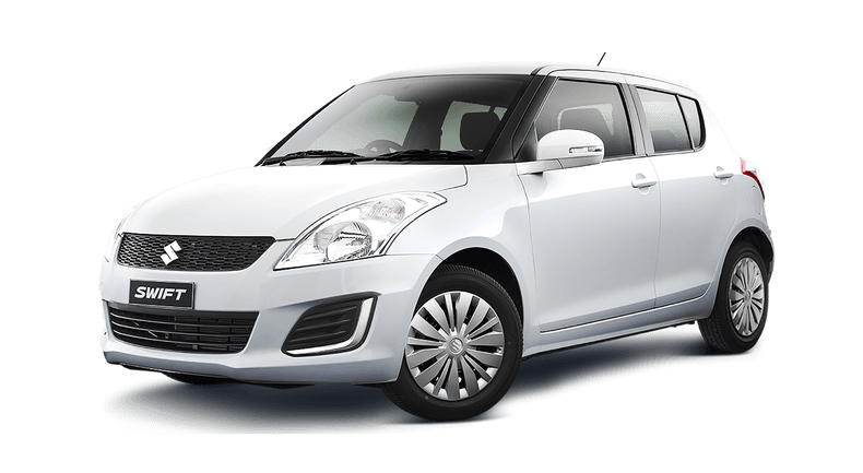
- Self-drive car. For families and friend groups carrying baskets, chairs, a stove and speakers (keep the speakers low). Read what you need to rent a self-drive car, or see the group rental.
- Bike and scooter. For college groups, couples and solo riders on the pretty stretches: the SH 3 boulders at Chanaka, Ukiam, Hahim and Chandrapur. See bike and scooty rental, and how pickup and return work.
- Private chauffeur-driven car. For large families, office outings, elders, and the long border drives to Bogamati, Ukiam and Pobitora, where nobody wants to drive back tired. Ask for the city cab for a day, or look at the cab rates in Assam.
Mixing is fine: a car for the family and gear, bikes for the riders. Our group picnic guide covers how to split a group, and the New Year picnic and cab guide covers the 1 January rush.
2027 picnic checklist and responsible travel tips
- Leave at or after 7:00 AM. It's what the new announcement asks, and it also beats the worst of the Sunday traffic on NH 27 and NH 17. Plan to be back before dark.
- Check the notice first. Look for the Transport Department or Kamrup Metro instructions for your date, and register if the portal is open.
- Carry cash. Village, parking and entry fees at the smaller spots are often cash only.
- Download offline maps. Signal drops at Ukiam, Garbhanga and some riverside spots.
- Check the water. Don't swim where the current is strong or the water is deep, keep children close, and follow any forest or local advisory.
- Carry documents. Driving licences, the vehicle's papers, and ID for everyone.
- Leave no trace. Take all your rubbish home, avoid thermocol and single-use plastic, and keep the noise down, especially at Deepor Beel and in the forest reserves.
- Check the date. Magh Bihu on 14 and 15 January and New Year's Day are the busiest days. A weekday in December or February is much calmer.
FAQs
What are the best picnic spots near Guwahati within 50 km? Kopili, Deepor Beel, Garbhanga, Hatisila and Barchapari, Katashil, Tapoban, Khamrenga Beel, Digaru and Tegheria Falls. Most are a morning's drive, and they fit comfortably into a daylight day.
Which picnic places near Guwahati are best for a bike ride? Chanaka and the SH 3 stretch, Hatisila and Barchapari, Tapoban and the Chandrapur road, Ukiam, and Hahim. Keep the luggage light, and for the longer rides pick a bike you're comfortable on.
What is the peak picnic season in Guwahati for 2027? November to February, with the peak in December and January. New Year's Day and Magh Bihu (14 and 15 January) are the busiest days. Check the Transport Department's announced rules for the season before you plan.
Which spots are best for large family groups with kids? Digaru for open space, Tapoban, Kopili, Chandubi for the boats, and the Assam State Zoo and Botanical Garden or a resort picnic when you want facilities and no cooking. The long border drives are better kept for older children and groups with a driver.
Can we rent a self-drive car or a chauffeur cab in Guwahati for a full-day picnic? Yes. You can rent a self-drive car or a bike, or hire a cab with a driver for the day. Tell us the date, the spot and the group size on WhatsApp.
Our cabs
Contact / Book
Planning a picnic this winter? Message us on WhatsApp with your date, your spot and how many are coming, and we'll help you pick a self-drive car, a bike or scooter, or a cab for the day.
The information in this post is indicative. Final terms and policies are discussed and confirmed when you take the vehicle on rent.
 NE INDIA
Par avion · By air mail
Get Northeast trip ideas and offers
Festival dates, road updates and rental offers from Guwahati, straight to your inbox.